ZIP Codes and the U.S. Postal Service
/Have you ever wondered about U.S. ZIP codes? Did you think they were named that because the system makes the mail extra zippy in its delivery? Well, you are partially correct. The system was an effort in 1963 to make U.S. mail delivery more efficient.
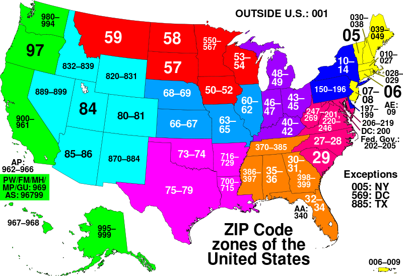
However, ZIP actually stands for something: Zone Improvement Plan! Before that year, there were postal assigned only within cities. For example: Detroit 19, Michigan. The current United States Postal Service (USPS) organizes the entire country by regions, as you can see on the map below. In general, smaller numbers indicate eastern locations, getting larger as they move westward.
Twenty years after the introduction, the ZIP code system was expanded to ZIP+4. Adding four more numbers. Using all nine digits is not required, but it speeds up delivery to homes and businesses because it is more precise in identifying locations. This might be a city block or a large business.